THE BERMUDA 100 CHALLENGE
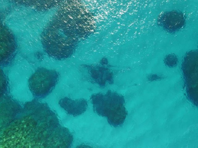
The Bermuda 100 Challenge intends to document at least 100 shipwreck and natural habitat sites in Bermuda waters, with an initial goal of focusing on some 20 sites among the 45 major known shipwrecks which sank in the 350 years up to the end of World War II. These include the Virginia Merchant (en route from England to Jamestown, Virginia). The vessel hit a submerged reef in 1661, killing 169 passengers. After 350 years, little remains of the wreck, apart from a pile of ballast stones as well as cannons and an anchor now displayed at the Royal Naval Dockyard. Other open wreck sites include: the HMS Cerberus (a British gunship sunk in 1783); the Caesar (wrecked on Bermuda’s reefs in 1818 en route to Baltimore); the Superior (1837); the Minnie Breslauer (1873); the Kate (1878); the Darlington (1886); the Emma Davis and the Norkoplin (both beached in 1919); the Caraquet (1923); and the trans-Atlantic luxury liner Cristobal Colon (1936).
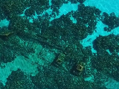
Four additional shipwrecks are already being documented and processed as part of the Bermuda 100: the Mary-Celestia; the Blanche King; the Montana, and the Constellation. Recent efforts to explore the wrecks have produced valuable insights and surprising artifacts, notably in connection with a June 2011 expedition to the Mary-Celestia. UC San Diego researchers are now producing 3D visualizations and flythroughs and compiling an exhaustive record of visual evidence of each site made available by authorities, explorers and conservators, including Bermuda’s Custodian of Historic Wrecks in the Department of Environment and Natural Resources.
This website aims to provide an archive of available multimedia, visualizations and other data documenting each site to be included in the Bermuda 100 Challenge, starting with the three sites mentioned above. As mandated by the country’s Historic Wrecks Act of 2001, “pioneering new standards for the management and study of Bermuda’s shipwrecks” now require that most of the data acquired for this project will also be included in the conservation department’s GIS Mapping Database.