BBuilt in 1875 in Sunderland, England, this tramp steamer was constructed by the shipbuilders Short Brothers. Tramp steamers used both sail and steam for propulsion, sailing on windy days but firing up coal-burning boilers to produce steam if the wind dropped off. The boilers became covered in soot – hence the ‘tramp’ steamer designation.
With a cargo of 4,000 bales of cotton, the Lartington departed Savannah, Georgia on December 8, 1879 destined for Russia. Four days later, she crashed into a Bermuda reef near Western Blue Cut after a giant wave (reportedly over 100 feet high) smashed into the ship and cracked her hull, causing a massive leak. Battling the storms and heavy seas, the water pumps couldn’t keep pace with the incoming sea, and Captain George Dixon decided to make a run for Bermuda rather than risk sinking in place. She almost made it, but ran aground on the reef five miles northwest of the island’s Royal Naval Dockyard after hitting a series of blind breakers known locally as "Pilchards & Dicks". Her momentum allowed her to travel another 200 yards. All the crew were rescued and most of the cargo salvaged.
CURRENT CONDITION
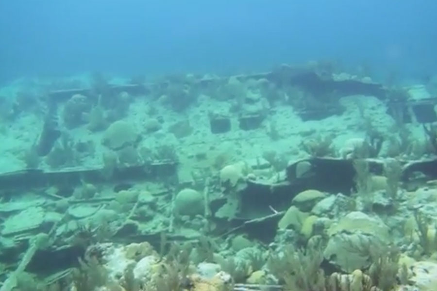
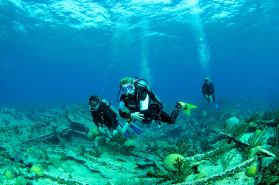
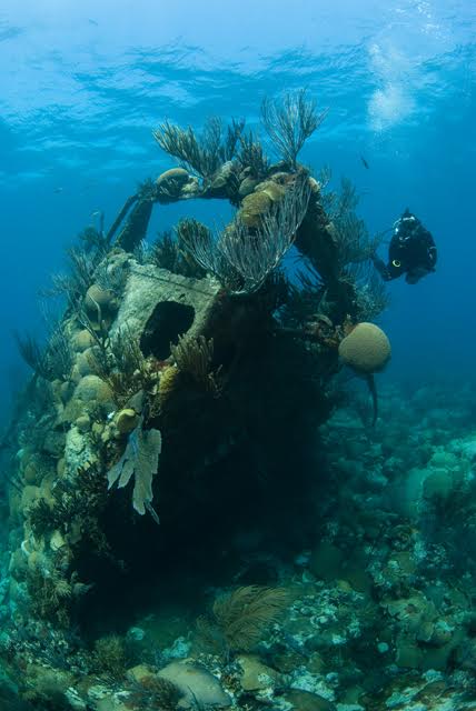
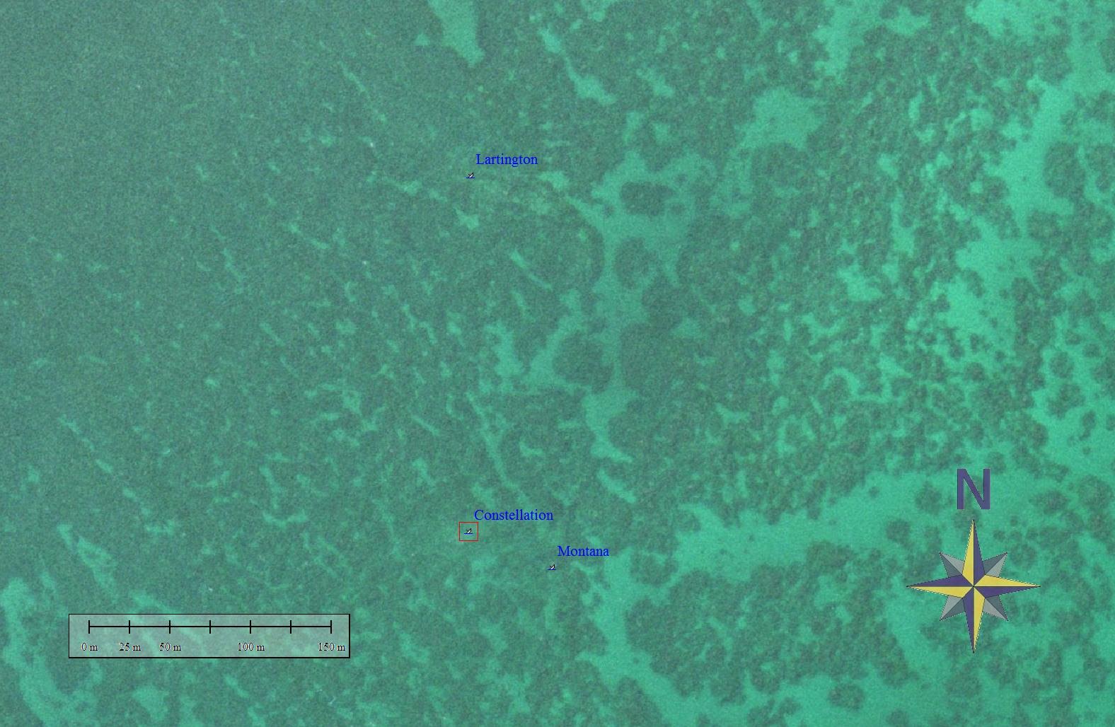
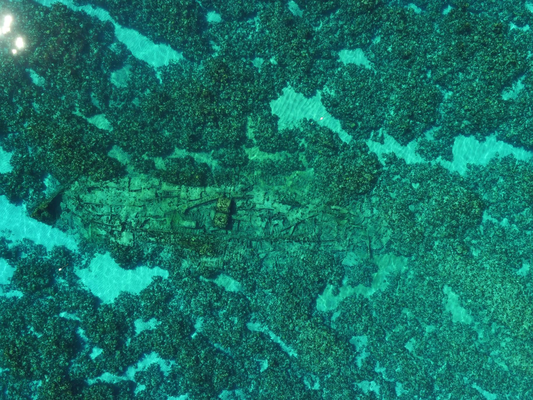
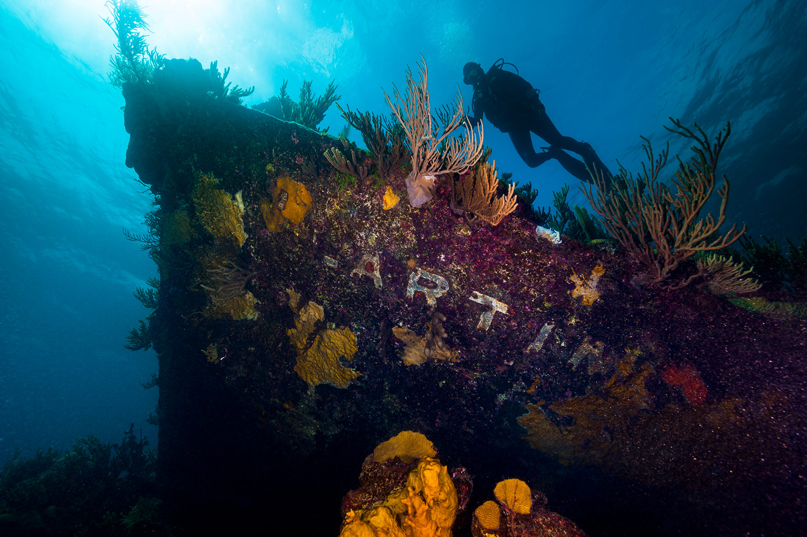
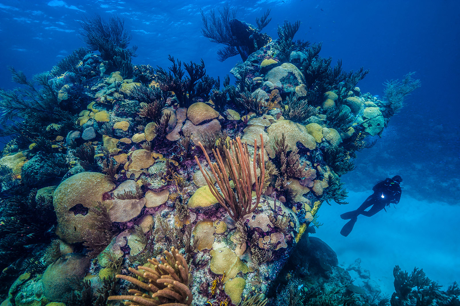
The Lartington came to rest just north of the Montana and the Constellation – creating a literal ‘Shipwreck Triangle’ for visiting divers to explore. Over the years, the Lartington collapsed on herself, and now lies on top of the reef. For most of the ensuing years, its location was lost to history, until local marine historian Mike Davis saw the name Lartington emblazened on her bow. The wreck sits in 15 to 35 feet (5-11 meters) of water. Divers find the wreck to be highly photogenic. Her upturned bow lies on its port side mostly intact, coming to within inches of the surface at low tide. The Lartington’s mid-section is crumbling and scattered, although her boilers are recognizable, and a broken prop is the highlight of exploring her stern. Visibility around the wreck is usually good, averaging 70 feet in the summer and in excess of 200 feet during winter months.
STATISTICS
Location: 32°21'49.21"N, 64°54'50.76"W Length: 245 feet (74.7 meters) Depth: 35 feet (10.7 meters) Tonnage: 878 tons Protected Area Radius - No Fishing: 300m